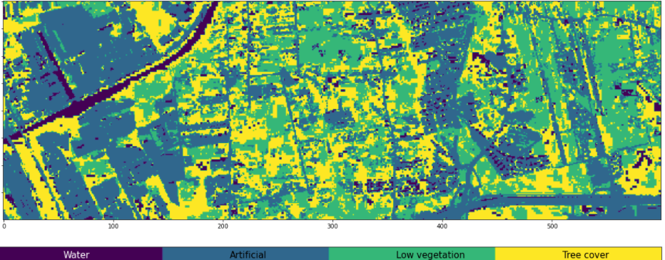
Land Cover Classification
Agriculture provides the most basic needs of humankind. New agricultural techniques should be able to meet future demands while maintaining or reducing the environmental footprint of agriculture. This project introduces an example of a supervised land cover classification with Sentinel-2 data. The aim is to classify a Sentinel-2 image into four different land cover classes: water surfaces, artificial surfaces, low vegetation and tree cover. This type of land classification allows for assessment and monitoring of land use changes, which is important for the sustainable management of natural resources, environmental protection, food security, and humanitarian programs.
The Challenge
Most metropolitan areas face increasing problems connected to irregular urban expansion, loss of natural vegetation, decreasing open space and general reduction of spatial extension. Towns have turned from small, isolated centres to big settlements. The importance of AI in monitoring land cover changes by means of Earth Observation(EO) data at various scales – continental, national and local – is crucial from at least two points of view because it reduces the photo interpretation loads and assures the objectivity of results.
Data
This project builds a decision tree model to classify a pre-processed Sentinel-2 image subset. The following operations were conducted in before-hand on the original Sentinel-2 image file:
- Subsetting to a dimension of (200, 600) pixels
- Resampling of all 13 bands to a 10 m resolution, and
- Saving the 13 bands as individual .tif files